Muir Woods National Monument - Guide to California's Muir Woods National Monument
Muir Woods National Monument in Mill Valley, CA
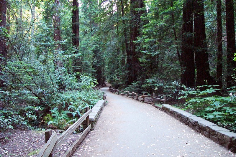
A Trail in Muir Woods National Monument
Muir Woods National Monument is a unit of the National Park Service on the Pacific coast of southwestern Marin County, California, 12 miles (19 km) north of San Francisco and part of the Golden Gate National Recreation Area. It protects 559 acres (226 ha), of which 240 acres (97 ha) are old growth Coast Redwood (Sequoia sempervirens) forests, one of a few such stands remaining in the San Francisco Bay Area.
On Jan. 9, 1908, Pres. Theodore Roosevelt signed legislation establishing Muir Woods National Monument. William and Elizabeth Kent had donated the woods to save the trees, and asked that it be named after John Muir. Upon learning of its dedication, Mr. Muir declared, "This is the best tree-lovers monument that could possibly be found in all the forests of the world."
Recreation Muir Woods National Monument
Muir Woods, part of the Golden Gate National Recreation Area, is a park which caters to pedestrians, as parking of vehicles is only allowed at the very entrance. Hiking trails vary in the level of difficulty and distance. Picnicking, camping and pets are not permitted.
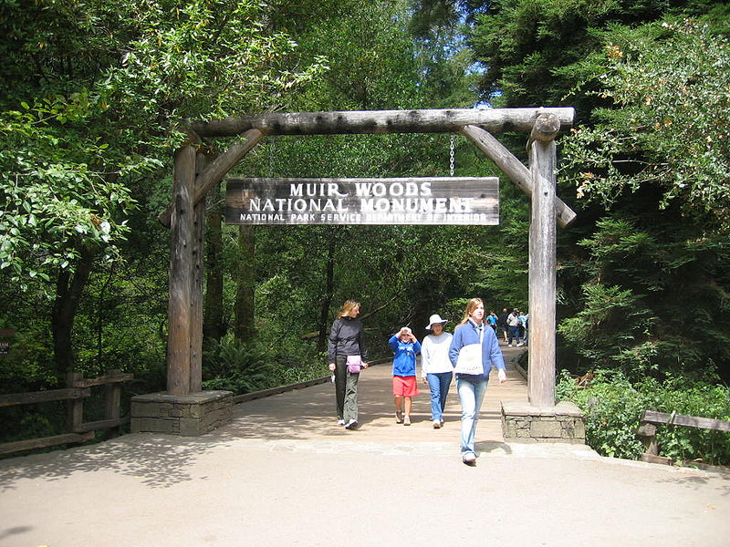
The entrance to Muir Woods National Monument
Facilities in Muir Woods National Monument
Lodging/camping
There are no camping or lodging facilities in the Muir Woods. The Monument is a day-use area only. There are camping facilities in the adjacent Mount Tamalpais State Park.
Comfort facilities
Restrooms
Aramark Cafe and Gift Shop – deli food items and souvenirs. Also
has a permanent display of historic photographs.
1.5 miles (2.4 km) of paved, wheelchair accessible trails
Interpretive facilities
Visitors Center with permanent and changing exhibits. Also contains a gift shop.
Activities in Muir Woods National Monument
Summer in Muir Woods
Summer arrived gently with an absence of rain. Redwood Creek is receding and the sculpting of last winter's handiwork on the creek bed is slowly emerging. Where a tree has fallen, water and gravity have worked to scour a deep pool around it. The cold, deep pool is a good place for developing coho and steelhead salmon to ride out the warmer, drier months of summer. Look for the salmon fingerlings downstream of one of the four bridges in Muir Woods. If it weren't for the coast redwoods rising some 200 feet (61 meters) or more above the forest floor, Redwood Creek and the understory plants would receive very little moisture in the summer. The ancient rainforest has a tall ally in the coast redwood which draws freshwater from the fog and shunts it to its dimunitive neighboring plants. Black-tailed deer, Sonoma chipmunk, fox, squirrel, bat, heron, duck, rodent, and owl are drawn to the cool shade of the creek, though few people have had the pleasure of seeing them. The animals are easily disturbed by loud sounds and tend to come out early or later in the day when the park is less crowded.
Old growth forests like Muir Woods are naturally quiet refugia in an increasingly noisy world. For information about the National Park Service's effort to protect the natural and cultural soundscapes that are so vital for wildlife and people.
Hiking and Biking in Muir Woods National Monument
One of the paved trails in Muir Woods
Muir Woods National Monument contains 6 miles of trails. There is a 1/2 hour loop, a 1 hour loop, and a 1 1/2 hour loop as well as longer hikes on trails that extend into surrounding parks. All of these walks afford views of thousands of old-growth coast redwoods, the tallest living things in the world. Pets, bicycles, smoking, horseback riding and camping are not permitted within the park. Food is not permitted except a light snack is permitted on the plaza and cafe deck.
Come early to enjoy a quiet walk in Muir Woods. The national park opens every day at 8 a.m. There are different looping trails that take a half-hour to two hours to complete. Refresh, renew, and be inspired by this national park. The monument has a number of paved walking trails (See below for the Trail Map) where visitors can get a close look at the magnificent giants. Other unpaved walking trails lead up the hills to connect with trails outside of the Monument boundaries. Bicycles are only allowed on fire roads.
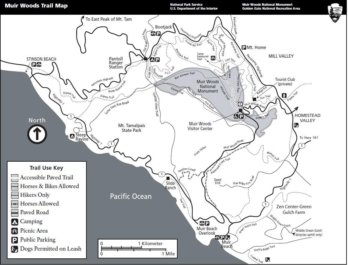
Muir Woods Monument Trail Map
The Hillside Trail is closed for maintenance. Consult the Muir Woods trail map for an alternate route.
The Main Trail between the north end of Cathedral Grove and the Fern Creek trailhead is closed due to tree fall. For a 1 hour, 1 mile walk, you can take the Main Trail from the entrance arch to Cathedral Grove, walk around Cathedral Grove, cross at Bridge 3, take the back trail to Bohemian Grove, cross at Bridge 1, and walk back to the entrance arch. This is an easy, level route that is paved or boardwalked.
Mount Tamalpais State Park Trails
Muir Woods National Monument is surrounded by California State Park property. Many trails to and from Muir Woods connect with Mount Tamalpais State Park trails. These trails are long, narrow, unpaved, and often steep, requiring sturdy shoes with good threads. If you are planning to exit the monument via a state park trail, we recommend that you purchase a Muir Woods NM Park Map which includes a Nature Self-Guide and Watershed Hiking Map. This map may be purchased for $1 at the Visitor Center or at the self-serve map box at Bridge 2.
The following Mount Tamalpais State Park Trails are closed:
Dipsea Trail between Sun Trail and Camino del Canyon. Closed indefinitely due to slide.
Bootjack Trail between Muir Woods boundary and Panoramic Highway. Closed between May 8, 2011 and January 2012 for maintenance.
Athletic Events
The annual Dipsea Race, a footrace which goes between Mill Valley and
Stinson Beach, passes through Muir Woods on the second Sunday in June.
The Double Dipsea, later in June and the Quad Dipsea, in November, follow
the same course.
Ranger-led activities
Sunlight on leaves and spider webs in Muir Woods
Ranger-led walks on a number of different topics, including discussions
on the watershed, wildflowers, and tidepools are held on weekends. Moonlight
walks are held on nights with a full moon. Reservations are required for
the moonlight walks.
Daily presentations are possible if staffing permits.
Special events are held for the summer and winter solstices.
Weddings
Weddings are allowed in the Monument with a proper permit.
Biology of Muir Woods National Monument
Flora

Undergrowth of a redwood canopy demonstrating the deep shadow under the trees. Note the clearing in the background showing other trees growing in the light.
The star attraction of the Muir Woods is the Coast Redwood (Sequoia sempervirens).
These relatives of the Giant Sequoia are known for their height. While
redwoods can grow to nearly 380 feet (115 m), the tallest tree in the
Muir Woods is 258 feet (79 m). Strangely, though, the trees come from
a seed no bigger than that of a tomato's.The average age of the redwoods
in the Monument are between 500 and 800 years old with the oldest being
at least 1,200 years old.
While overshadowed (and shaded) by their tall cousins, other tree species
grow in the understory of the woods. Three of the most common are the
California Bay Laurel, the Bigleaf Maple and the Tanoak. Each of these
species has developed a unique adaptation to the low level of dappled
sunlight that reached them through the redwoods growing overhead. The
California Bay Laurel has a strong root system that allows the tree to
lean towards openings in the canopy. The bigleaf maple, true to its name,
has developed the largest leaf of any maple species allowing it to capture
more of the dim light. The tanoak has a unique internal leaf structure
that enables it to make effective use of the light that filters through
the canopy.
Fauna in Muir Woods National Monument
Fish
Redwood Creek provides a critical spawning and rearing habitat for coho or silver salmon (Oncorhynchus kisutch), coastal cutthroat (Oncorhynchus clarki clarki) and steelhead trout (Oncorhynchus mykiss), each of them threatened species. The creek is near the southernmost limit of coho habitat and the fish have never been stocked, so they have a distinctive DNA. The Redwood Creek salmon are Central Coast Coho Salmon which have been listed as federally threatened species since October 2006 and as federally endangered species in June 2005. Coho migrate from the ocean back to freshwater for a single chance at reproduction, generally after two years in the ocean. The spawning migrations begin after heavy latefall or winter rains breach the sandbar at Muir Beach allowing the fish to move upstream (usually in December and January). No salmon were seen in the 2007–2008 winter run, nor the 2008–2009 winter run. Evidence points to exhaustion of smolt oversummering in the creek due to a loss of large woody debris and deep pools where young salmon can rest. Starting in 2009, the National Park Service began restoring Muir Beach to create a functional, self-sustaining ecosystem and improve visitor access.The intervention was almost too late, since the coho only has a three year life span. Fortunately, as of January, 2010, and for the first time in three years, an estimated 45 Coho swam up Redwood Creek to spawn, creating 23 redds or clusters of eggs. In 2011, 11 live adult coho and 1 coho carcass was observed, along with three redds, a modest increase over the 2007-2008 spawning season. Statewide the coho population is 1% of its levels in the 1940s and the fish have vanished from 90% of the streams they formerly visited.
Birds
Muir Woods is home to over 50 species of birds. This relatively low number
is due to the lack of insects. The tannin in the trees repels the insects
and the volume of flowers and fruits produced by plants below the canopy
is limited by the shade of the redwoods.
It is occasionally possible to see Northern Spotted Owls or pileated woodpeckers
in the forest. While decreasing in numbers elsewhere, the Spotted Owls
appear to be thriving in the Monument and other evergreen forests in the
area. A National Park Service monitoring project of the owls is ongoing
within the Monument. The project has found that adult owls are finding
mates, raising young to adulthood and the young are having new broods
of their own.
Mammals
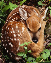
Black-tailed deer fawn like the one pictured above are often born in Muir Woods. The gentle rustling of leaves heard in the quiet early morning or late evening are a clue to seeing them foraging with their mother.
The Monument is home to a variety of mammals ranging in size from the
American Shrew Mole to much larger deer. The majority of the mammals are
not seen as they are nocturnal or are burrowing animals living under the
ground or the dense litter on the forest floor. Most commonly seen are
Sonoma chipmunks, and Western gray squirrels.
Bears historically roamed the area but were largely exterminated by habitat
destruction. In 2003 a male black bear was spotted wandering in various
areas of Marin County, including Muir Woods.
There are 11 species of bats that call the Monument home, often using
hollows burned into the redwoods by past fires as a maternity colony.
In November, 2010 Sea otter (Enhydra lutris) have been spotted swimming
in the new stream channel constructed in the lagoon area of Redwood Creek.
Climate in Muir Woods National Monument
Below is the current temperature and weather forcast Muir Woods National Monument
The park is cool, shaded and moist year round. Daytime temperatures range between 40 and 70 degrees Farenheit. Rainfall is heavy during the winter and summers are almost completely dry with the exception of fog drip caused by the fog passing through the trees. Annual precipitation in the park ranges from 39.4 inches (1,000 mm) in the lower valley to 47.2 inches (1,200 mm) higher up in the mountain slopes.
Location of Muir Woods National Monument
For the location use following GPS cordinates of Muir Woods National Monument 37°53'56"N 122°35'2"W. The address of Muir Woods National Monument is Muir Woods National Monument, Mill Valley, CA, 94941-2696 and the map is shown below:
Here is a detailed list of other National Parks of California besides Muir Woods National Monument.
| National Parks of California | |||||||||||||||||||||||||
|---|---|---|---|---|---|---|---|---|---|---|---|---|---|---|---|---|---|---|---|---|---|---|---|---|---|
|
|||||||||||||||||||||||||
Camping Resources
Free Services
Free Text MessagesFree Picture Messages
Free Fax
Free Calls