California Camping
California Camping SitesNational Parks of California
California State Parks
State Parks Camping Fees
State Parks Day Use Fees
State Parks WiFi Access
Point Sal State Parks on the Beach - Guide to Point Sal State Beach
Point Sal State Beach in Guadalupe, California (in Santa Barbara County)
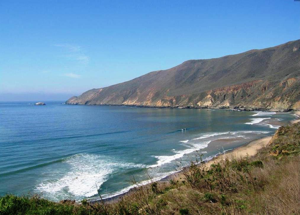
Point Sal State Beach is a beach on the Pacific coast of California, located near the city of Guadalupe, in the northwestern part of Santa Barbara County. There are approximately 80 acres (320,000 m2) of property and only 1.5 miles (2.4 km) of ocean frontage. This beach is at risk of landslides as there are rocky shorelines and extremely steep slopes.
Lands above the beach and rocky shoreline have extremely steep slopes, and numerous landslides are evident. Prime examples of coastal sage and chaparral communities occur on these slopes. Giant coreopsis is abundant in the area and dominates wildflower displays in the spring.
Views of the coastline, beach and rugged mountain slopes are exceptional. Lion Rock, located offshore, is an important bird-roosting site and is also used by sea lions and other marine mammals
Recreation Activities in Point Sal State Beach
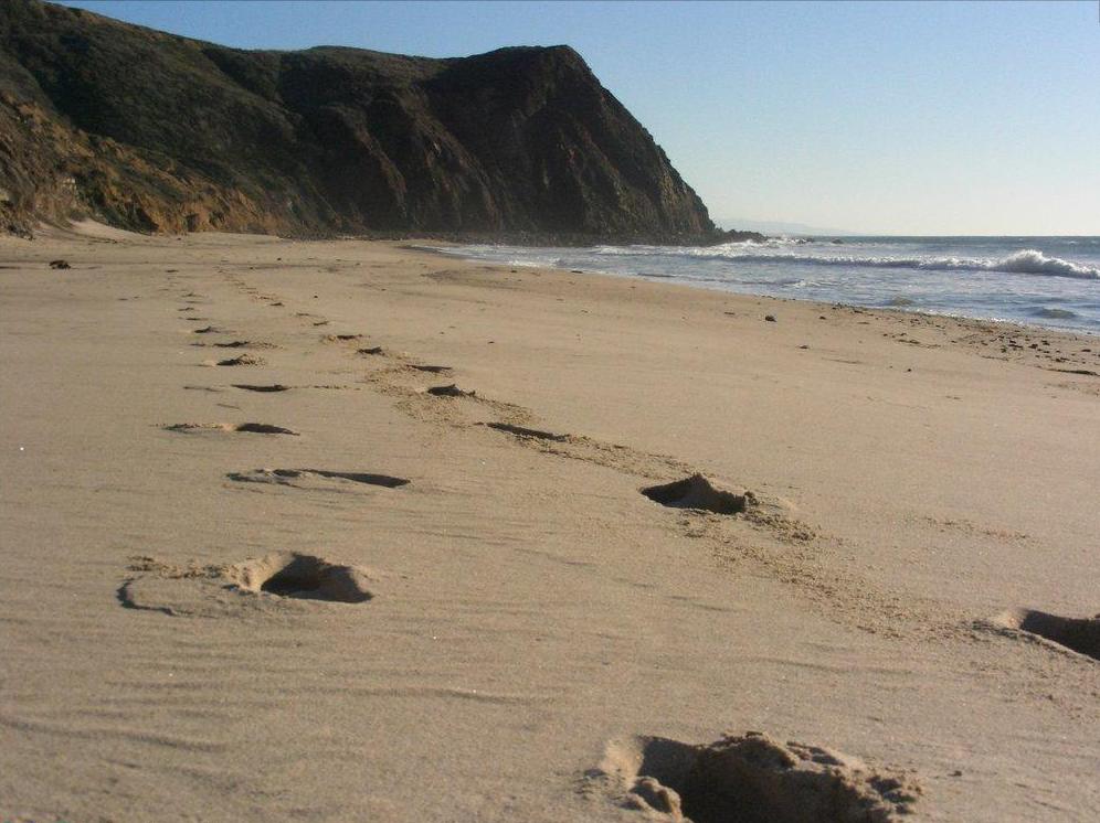
Among the most popular activities are fishing, beach combing, hiking, nature study, photography, picnicking and sunbathing. However, swimming is not recommended due to dangerous rip currents, absence of lifeguard service, and occasional shark sightings. Camping is prohibited due to security concerns involving Vandenberg Air Force Base and anyone caught camping can be subject to citation, arrest, and eviction by the Park Rangers and/or Air Police. There are also no recreational facilities (toilets, picnic tables, etc.)
Hiking in Point Sal State Beach
Vandenberg Air Force Base coast line
From State Beach to Point Sal is 5 miles round trip.
When your eye travels down a map of the Central California coast, you
pause on old and familiar friends-the state beaches at San Simeon, Morro
Bay, and Pismo Beach. Usually overlooked is another state beach-remote
Point Sal, a nub of land north of Vandenberg Air Force Base and south
of the Guadalupe Dunes. Windy Point Sal is a wall of bluffs rising 50
to 100 feet above the rocky shore. The water is crystal-clear, and the
blufftops provide a fine spot to watch the boisterous seals and sea lions.
Point Sal was named by explorer Vancouver in 1792 for Hermenegildo Sal, who was, at that time, commandante of San Francisco. The state purchased the land in the 1940s.
During the winter of 1998, portions of the 9 mile long access road to the beach were washed out by winter rains. The road has not been repaired and remains closed to vehicles. At this writing, Point Sal State Beach is accessible only to visitors who mountain bike or hike to the beach.
Alternatively, the strong hiker can trek twelve miles (round trip) to the state beach from Rancho Guadalupe Dunes County Park located to the north of Point Sal. Bold cliffs, towering sand dunes and isolated beaches combine to offer a tableau to remember.
If you do manage to get to Point Sal State Beach, the walk north can be a challenging one-on the bluffs above rocky reefs. At low tide, you can pass around or over the reefs; at high tide the only passage is along the bluff trail. Both marine life and land life can be observed from the bluff trail. You'll pass a seal haul-out, glimpse tidepools, sight gulls, cormorant and pelicans, and perhaps see deer, bobcat and coyote on the ocean-facing slopes of the Casmalia Hills.
The trail system in the Point Sal area is in rough condition. The narrow bluff trails should not be undertaken by novice hikers, the weak-kneed or those afraid of heights. Families with small children and less experienced trekkers will enjoy beachcombing and tidepool-watching opportunities at Point Sal and the pleasure of discovering this out-of-the-way beach.
Directions to trailhead: (Remember to call about the road closure.) From Highway 101 in Santa Maria, exit on Betteravia Road. Proceed west past a commercial strip and then out into the sugar beet fields. Betteravia Road twists north. About eight miles from Highway 101, turn left on Brown Road. Five miles of driving on Brown Road (watch for cows wandering along the road) brings you to a signed junction; leftward is a ranch road, but you bear right on Point Sal Road, partly paved, partly dirt washboard (impassable in wet weather). Follow this road 5 miles to its end at the parking area above Point Sal State Beach.
The hike: From the parking area, follow one of the short steep trails down to the beautiful crescent-shaped beach. Hike up-coast along the windswept beach. In 0.3 mile, you'll reach the end of the beach at a rocky reef, difficult to negotiate at high tide. A second reef, encountered shortly after the first, is equally difficult. Descend carefully to the beach.
Unless it's very low tide, you'll want to begin following the narrow bluff trail above the reefs. The trail arcs westward with the coast, occasionally dipping down to rocky and romantic pocket beaches sequestered between reefs.
About 1.5 miles from the trailhead, you'll descend close to shore and begin boulder-hopping. After a few hundred yards, you'll begin to hear the bark of sea lions and get an aviator's view of Lion Rock, where the gregarious animals bask in the sun. Also be on the lookout for harbor seals, often called leopard seals because of their silver, white, or even yellow spots.
Your trek continues on a pretty decent bluff trail, which dips down near a sea lion haul-out. (Please don't approach or disturb these creatures.) You'll then ascend rocky Point Sal. From the point, you'll view the Guadalupe Dunes complex to the north and the sandy beaches of Vandenberg Air Force Base to the south. Before returning the same way, look for red-tailed hawks riding the updrafts and admire the ocean boiling up over the reefs.
Location of Point Sal State Beach
The Point Sal State Beach is located at 34°54'05"N 120°38'53"W. The Point Sal State Beach address is La Purisima Mission SHP, 2295 Purisima Road, Lompoc, CA 93436.
There are four ways to access Point Sal from Highway 1. One way is to travel west on Brown Road (junction with Highway 1 is approx. 2 miles (3.2 km) south of downtown Guadalupe). Another is to drive east on Main street in Guadalupe, leading to a small parking lot on the beach. Other two ways involve going through Casmalia. One way towards Casmalia is Lompoc Casmalia Road (junction with Highway 1 near Vandenberg Air Force Base) while the other is Black Road (between Highway 135 and Brown Road; Black Road turns into Lompoc Casmalia Road as it approaches Casmalia). From Casmalia, Point Sal can be accessed by traveling west on Point Sal Road (by the Hitching Post Restaurant). However, there are only pedestrian access to Point Sal; bicycles and vehicles are prohibited. Visitors must have at least some hiking experience and to those who are arriving by vehicles must find a nearest parking spot and walk along Point Sal Road to Point Sal.
Point Sal State Beach can be contacted at 805-733-3713.
Here is a driving map to Point Sal State Beach.
Here is a detailed list of other state beaches of California besides Point Sal State Beach.
| California State Parks on the Beach | ||||
|---|---|---|---|---|
|
||||
Camping Resources
Free Services
Free Text MessagesFree Picture Messages
Free Fax
Free Calls